The Ganga plain which dominates the landscape and nearly covers three fourth of the geographical area of the State, lies between the rocky Himalayan belt in the north and the southern hilly tract comprised of mainly Pre-Cambrian rocks. Flexing of the Indian lithosphere in response to the compressive forces due to collision, and thrust fold loading produced the Ganga Plain foreland basin. It is filled with recent alluvial sediments which are at places more than 1,000 m. thick and an amalgam of sand, silt, clay in varying proportions. 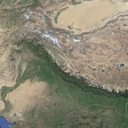
The southern hilly tract is roughly parallel to the Ganga-Yamuna lineament. The tract is underlain by granitic complex in Bundelkhand region and in Sonbhadra. It is overlain by rocks Mahakoshal (Bijawar) and Vindhyan Super group. The younger rock comprise of coal bearing Gondwana in south Sonbhadra and basaltic rocks in southern part of Lalitpur.
The granitic complex is considered to be potential for the search of metallic minerals like copper, lead, zinc, molybdenum, gold, nickel, Uranium and Platinum group of elements. The overlying sediments of Mahakoshal (Bijawar) and associated Iron Formation show a potential for the search of copper, uranium, and gold in Lalitpur and andalusite, sillimanite, gold, calcite, marble and clay in sonbhadra.
The lower Vindhyan sediments of Sonbhadra contain deposits of cement grade limestone, flux grade dolomites, building stone and are also potential for the search of placer gold and other metals.
The Upper Vindhyan sandstones are suitable for making decorative slab/tiles or ballast. Deposits of silica sands and bauxite are available in Allahabad and chitrakoot districts while coal deposits occur in the Gondwana rocks in southwestern corner of Sonbhadra.
The thin strip of land running from Saharanpur in the west to Deoria in the east is known as Bhabhar and Terai. The Bhabhar area in Saharanpur, Bijnor and Pilibhit districts skirts round the Shivalik hills. Torrential streams and rivers desending the mountaineous slopes slow down here, leaving behind boulders brought from the upper reaches of the Himalayan hills. Some 34 Kilometers in width in the west, the tract goes on getting narrower in its march towards the east. Smaller streams seem to get lost in the thick mass of boulders but reappear some distance away, moving slowly and depositing a thin layer of soil which converts itself into a marshy patch called the Terai.
The Terai area, which runs through parts of Saharanpur, Bijnor, Rampur, Barelly, Pilibhit, Lakhimpur Kheri, Bahraich, Gonda, Basti, Siddarthnagar, Gorakhpur, Mahrajganj and Deoria districts was once a belt, some 80 to 90 kilometers wide , covered with forests and tall, dense grasses. In the recent years, however, owing to the land acquisition programme of the State Government the Terai belt has shrunk considerably, Wheat, rice and sugar cane are the main crops grown in Terai together with jute in certain stretches.
Outside the Terai and Bhabhar belt, the plains are fertile and flat save certain trans-Yamuna portions in Agra and Mathura districts where ravines and red stone hillocks abound on the eastern end of the Arawali range.
Irrigated by Ganga, Yamuna and their tributaries, the plains slope in two formations- from north to south in the west and west north to south east in the east, yielding two major crops a year i.e. rice in Kharif & wheat in Rabi Season.
- UPPCS Mains Tests and Notes Program
- UPPCS Prelims Exam 2024- Test Series and Notes Program
- UPPCS Prelims and Mains Tests Series and Notes Program
- UPPCS Detailed Complete Prelims Notes